It’s going on 15 years since the movement to convert Santa Monica Airport into a Great Park began. Back then, in the early twenty-teens, the focus was on making sure Santa Monica could close the airport. This was because the Federal Aviation Administration (FAA) reneged on its agreement, contained in a 1984 settlement with Santa Monica, that in 2015 the City would have the right to do so. The efforts of the pro-park activists involved not only encouraging the City to sue the FAA, but also fighting off in 2014 a ballot initiative from the aviation industry that would have kept the airport operational forever.
In 2017 the City won the right to close the airport after 2028. It wasn’t a perfect victory, since the FAA managed to squeeze the City for another 13 years of airport operations, but it was a victory. Not much happened for about seven years. Then in 2023 the City Council began planning for closure and for building the park in earnest, and began and funded the Santa Monica Airport Conversion Project.
(At this point I should note that I am one of those pro-park activists. I sit on the boards of two organizations dedicated to converting the airport into a park: the Santa Monica Airport2Park Foundation and the Santa Monica Great Park Coalition. The views I express here, however, are solely my own and not those of either group.)
The first stages of the process were to hire a team of consultants (led by the internationally famous park designers Sasaki), and then to start collecting inputs from the public by workshops and surveys. Based the data collected, the City Council first adopted general principles to guide the planning and then, last July, directed staff and the consultants to begin design work for the park.
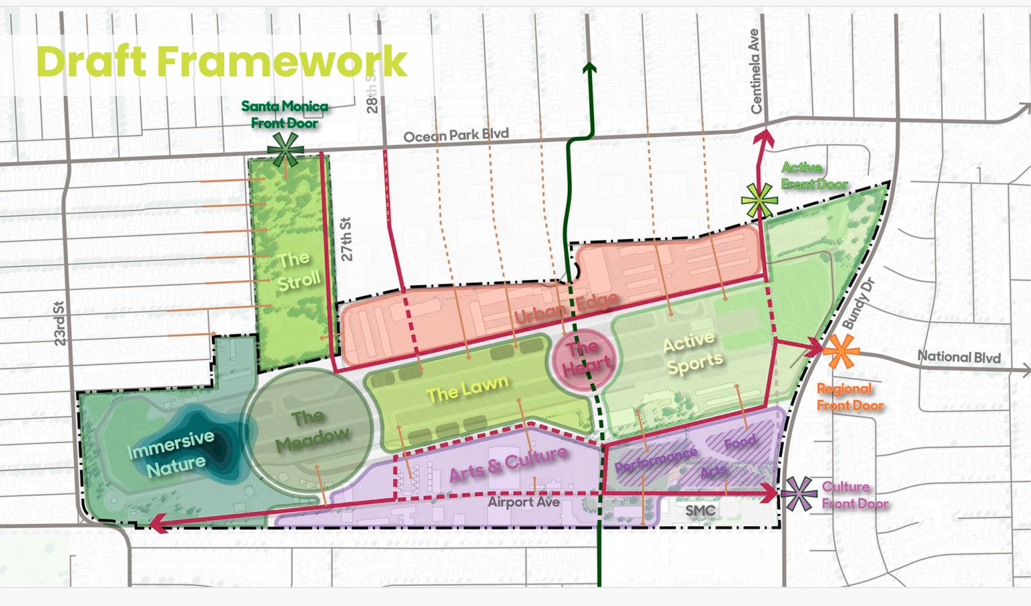
How do you make about 200 acres of land satisfy, let’s say, 1,000 acres of park-use ideas? Staff and the consultants took a classic approach to solving a big problem: they broke it into smaller pieces. What they came up with is called the Framework. With the Framework they divided the 192 acres of airport land (to which they smartly added the adjacent 17 acres of Clover Park) into eight “districts,” each designed to serve a different park function. Here’s the diagram:
Staff is now presenting the Framework to various boards and commissions, and will present it to City Council at a meeting now scheduled for May 12.
I don’t have space here to describe each district, but you should follow the link and review the 44 slides that describe the whole program. (And then complete the survey, which is open until April 26.)
I can make some general observations (and share some general opinions) based on the diagram. The heart of the Great Park will be the mile-long space that was the runway. The plan is to begin on the western end with more natural uses, and then, moving eastward, gradually feature more programmed uses. On the west, the first district is “Immersive Nature,” and on the east is “Active Sports.” On way we pass through the “Meadow,” the “Lawn,” and the “Heart.”
On the north and south, which are now the areas of the airport most developed with existing structures, there will be cultural facilities (some of which already exist), or uses like cafes, restaurants and community centers. The northern district, facing the business park on Ocean Park Boulevard, is called “Urban Edge.” It is going to retain commercial buildings that the City currently leases to businesses. To the south the district is called “Arts and Culture.”
The only exception to this pattern is the incorporation of Clover Park into the Great Park, as a district called the “Stroll.” This district, as you may have guessed from the name, is meant to serve as the principal entrance into the park from the north.
The west-to-east pattern makes sense, given the topography. The bluffs on the west make access from the west (23rd Street) difficult, while on the east, where will be located the sports fields, there are access points from the north and from Bundy Drive on the east.
I also like how the designers are clustering uses, which makes for a more efficient use of space. However, I see more complexity than is needed. Four of the districts—the Meadow, the Lawn, the Heart, and the Stroll—are all quite similar in form and purpose. While there are differences, all four districts have uses that “blend everyday activity with nature,” or that support “everyday moments like family picnics,” but can also host “community gatherings and celebrations.” They will include “multi-use paths” and “grassy enclaves/knolls.”
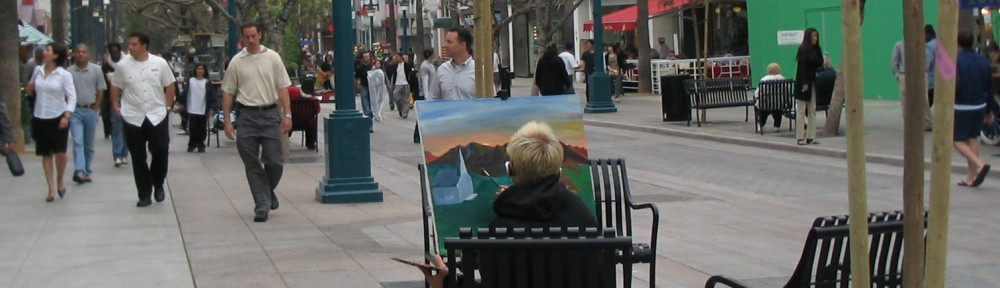
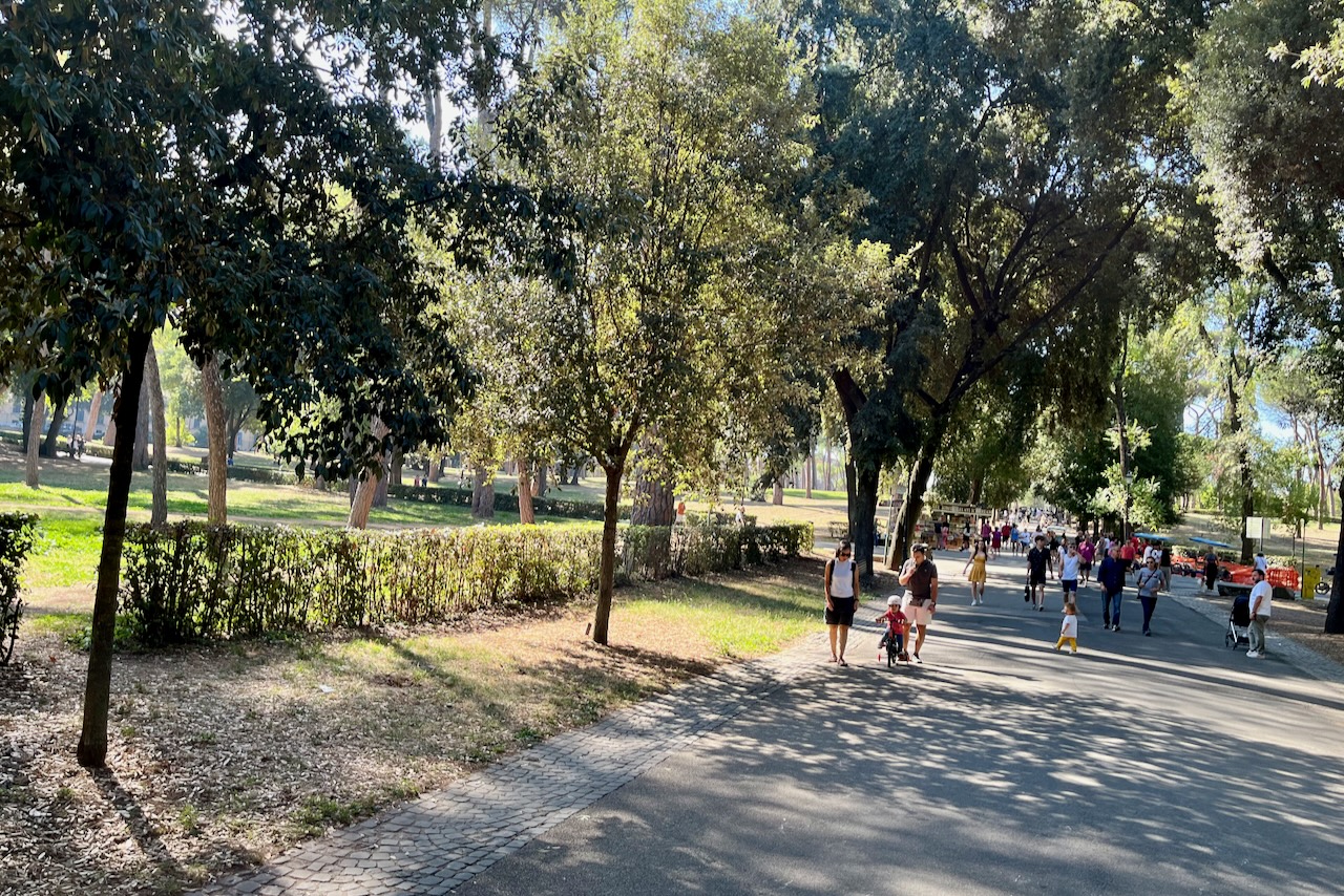
My use of these quotes is not sarcastic—in fact, quite the opposite. I love it that the planners would dedicate a large part of the park to passive, but people-oriented uses. A few years ago in a blog post I suggested that a park in Rome, the Villa Borghese, could be an inspiration for our Great Park. Much of the Villa Borghese resembles what one would expect these four districts to be like.
(What I don’t seen in the Framework are picnic tables and barbecues, although maybe they are covered by the phrase, “family picnics.” Given that 75% of Santa Monicans live in apartments, picnic tables are a necessity, scattered wherever appropriate.)
I’m no expert on the costs of building parks, but I would expect that the relative passivity of the uses in these four districts would mean that the existing tarmac could be converted for these purposes more quickly and with less expense than required for more elaborate uses. Specific features, from gazebos to water features, could be added over time, as funds become available.
But costs and phasing are for the next stages of planning, after City Council gives direction on what specific uses the eight districts should contain. I don’t envy the council that job. It’s going to hard to stuff 1,000 acres of hopes into 200 acres of reality.
Thanks for reading.